1. SOCIO-ECONOMIC PROFILE OF KILIMANJARO REGION
Kilimanjaro Region is one of Tanzania’s 31 administrative regions, locatedon the North Eastern part of mainland Tanzania, just south of the equator(20 25’ and 4015’ S; 360 25’ 30’’ and 380 10’ 45’’ E) and it covers an areaof 13,209 square kilometres. The region is bordered to the North and East by Kenya, to the South by the Tanga Region, to the Southwest by the
Manyara Region, and to the West by the Arusha Region.
It is among the smallest regions in Tanzania, which comprise six district councils and one municipal council namely Rombo district, Same district, Mwanga district, Hai district, Moshi district, Moshi municipal, and Siha district.
The regional headquarters is in Moshi. According to the 2012national census, the region had a population of 1,640,087. For 2002- 2012, the region’s 1.8 % average annual population growth rate was the 24th highest in the country.
It was also the eighth most densely populated region with 124 people per square kilometre. The Chagga and the Pare are the two main ethnicgroups found in Kilimanjaro region. The Chagga reside on the slopes of Rombo, Hai and Moshi districts while the Pares are found in the Pare mountain ranges of Mwanga and Same districts.Two smaller ethnic groups, the Wakwavi and Wakahe, are found in the lowlands of Moshi, Mwanga and Same districts. Although the region forms the smallest administrative area in Tanzania, it is highly significant to the development of the country, and has distinct biophysical and socioeconomic characteristics from the rest of the country.
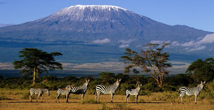
The region is also home to a large portion of Kilimanjaro National Park. Mount Kilimanjaro, is the highest mountain in Africa, which is also the most defining feature of Tanzania. Majority of the soils in the region are of volcanic origin, generally rich in magnesium and calcium. Climax vegetation on the mountain is montane rain forest, degrading to woodlands and then open grasslands along the slopes. About 48.7% of the total land area is arable, 21.3% is under game reserves, 15.3% under grasslands and rangelands, 12.4% under forest reserves and 2.3% under lakes, dams and rivers. Actual land use can be divided into three zones, along the mountain gradient. The mountain peak lies between 1,800 and 5,895 metres above sea level with annual rainfall of more than 2000 mm, and includes Kilimanjaro National Park and Rau Forest Reserve with high ecological values. The Highlands Zone lies between 900 and 1,800 m above sea level, and hosts the Agro forestry based Chagga gardens that integrate trees/shrubs with food and cash crops and livestock on the same land unit. The Lowland Plains lies below 900m above sea level with rainfall of between 700 and 900 mm, and temperature of 30C is largely used as off-site fields for annual crops such as cereals, legumes and sugar cane.
The Kilimanjaro ecosystem provides provisioning services, cultural services and supporting services (soil formation, nutrient cycling and primary production). Indeed, the region hosts about 2,500 plant species and 179 bird species, some of them endemic. The watershed is critical for regulating hydrological flows to the Pangani River basin, which flows into the Indian Ocean. The catchment also provides drinking water, traditional small holder irrigation and power generation for the national grid. The mountain acts as major climate modifier and supports tourism industry, hosting close to 45,000 tourists annually.
1.2. Geography and Climate
The largest part of the region is mountainous, surrounded by Pare Mountains that range from the base of Mount Kilimanjaro. This zone has increasingly become, and has always been, the most densely populated – even up to an altitude of 2,400 m above sea level. Due to the steep hills, land has become very scarce in the region, and forced out-migration to other regions in Tanzania. A smaller part of the lowlands in the west comprises of marshland, which goes along Pangani River. Contrary to the dry Maasai plains, this part of the lowlands can be cultivated. In the mountain areas farming is based on the cropping of banana, sugarcane, coffee, potatoes and yams, whereas in the lowlands the majority of the populations, including the nomadic Maasai, are cattle-keepers.
The Kilimanjaro region has typically two distinct rainfall seasons; August to October and February to April, with the driest months occurring between November and January. Rainfall decreases rapidly with increase in altitude; thus the mean precipitation is 2300 mm in the forest belt (at 1,830 m), 1300 mm at Mandara hut on the upper edge of the forest (2,740 m), 525 mm at Horombo hut in the moorland (3,718 m), and less than 200 mm at Kibo hut (4,630 m) which has desert-like conditions.
1.3 Land use:
About 48.7% of the total land area is arable, 21.3% is under game reserves, 15.3% under grasslands and rangelands, 12.4% under forest reserves and 2.3% under lakes, dams and rivers. Actual land use is however highly influenced by three distinct agro-ecological zones based on altitude, soils and climate. The zones include the peak of Kilimanjaro Mountain (1,800 to 5,895 metres above sea level.), the Highlands (900 to 1,800 metres above sea level) and the Lowland /Plains (below 900 metres above sea level).
Agro-ecological zones:
The region may be divided into three agro-ecological zones, namely, the Lowlands (1,500 m and below); the Highlands (1,500-3000 m); and the Forest (above 3000 m). With the exception of land above 3000 m, most of the land can be used for agricultural activities. Agricultural land on the other hand can be classified into four main zones: The Coffee zone, which can grow coffee, bananas, maize, beans and dairy cattle. The Wheat zone, where the agricultural activities include Wheat, beans, maize and dairy production. The Lower zone includes areas suitable for ranching as well as areas suitable for maize, cotton, beans and paddy. The Forestry zone, accounts for 388,500 ha of forest and National park.
1.3.1 The Coffee Zone:
The zone is the typical one of the region. It is intensely cultivated with coffee and bananas in pure or mixed stands, and is very densely populated and forms the core of the region’s economy. Although more than 60% of the zone gets 1,000 mm or more of rainfall annually, much of this rainfall is concentrated in the rainy season. Consequently, in the dry season those crops which are not irrigated suffer from lack of water.
1.3.2 The Wheat Zone:
This zone is located in the western part of Mt. Kilimanjaro and suitable for wheat, beans, maize and dairy, though other crops can also be grown. Often private farmers do wheat crop production on a large scale. The farms planted with wheat are located in areas with annual rainfall of 600 to 700 mm but due to year-to-year fluctuations in the rainfall, the wheat yields are not stable. In addition to dairy farming practiced by large farmers, beef cattle and goats are grazed on natural pastures called the Maasai steppe.
1.3.3 The Lower Zone:
The lower zone borders Moshi and Hai Districts, extends South of the banana/coffee zone on the southern slopes of Mt. Kilimanjaro and borders at its southern most end with the Kikuletwa River. The landscape is generally very gentle except the area to the north of the highway connecting Arusha and Mombasa where the landscape is mildly rolling. The Rombo district lower zone on the other hand, borders with and extends to the East of the coffee zone and on the East, it borders the Republic of Kenya. The Pare district lower zone encompasses a large area of flat land that stretches to the east of the hills of north and south Pare (Mwanga and Same) and reaches up to the national border with the Republic of Kenya. Two thirds of this zone is taken up by the Mkomazi game reserve. Depending on the location, the lower zone (Moshi and Hai districts) can accommodate a variety of agricultural activities. In the south eastern part of the lower zone where irrigation water is available, paddy, and maize are cultivated in rotation and in many cases double-cropping of paddy and maize or maize followed by maize is practiced. In Moshi district, this part is endowed with abundant subterranean water, and has many springs including Miwaleni spring which would support irrigation farming with minimum effort. The Rombo lower zone is suitable for rain fed cropping activities because it gets some rain during the long and short seasons. (Crops like finger millet, maize, beans and groundnut). Most farms in the lower zone are owned by farmers who commute from their homes in the coffee zone.
1.3.4 The forestry Zone:
The forestry zone in the district of Hai, Moshi and Rombo forms the Kilimanjaro National park. They border the coffee zone and are covered by forests. In Rombo and Hai districts, Irish potatoes and maize are grown at the height of between 1,800 to 2,000 m above sea level in re-forested blocks. However, the forestry zone in Pare district consists of steep
mountains which are poorly covered by trees.
1.4 Socio-economic context
Kilimanjaro region ranks higher than many parts of the country in terms of socio-economic indicators. According to 2017 Tanzania Human Development Report, the region’s Gross Domestic Product (GDP) was Tshs 3,606,689 in 2016 and its GDP per capita was Tshs 2,123,528. In terms of income poverty, data collected by Household Budget Survey in 2012, the proportion of people living below basic needs poverty line for Tanzania Mainland is 28.8 percent; the same statistic for Kilimanjaro region is 14.3 percent. With regard to Multi Dimensional Poverty Index (MPI)1, the proportion of poor people in Kilimanjaro region is 22 , which is relatively very low compared to national average of 47.4 percent. On the other hand, with Human Development Index (HDI) score of 0.75, Kilimanjaro region ranks at 1st position among the 26 regions of Tanzania Mainland. The average HDI score for Tanzania Mainland is 0.61 (source: Kilimanjaro region investment guide).
2. THE KILIMANJARO REGIONAL OFFICE:
SIDO Kilimanjaro Regional Office is situated along Sukari Road 1 km from the Municipal center close to Mbuyuni bus station. It is within the SIDO’s Industrial Estate, which covers an area of 8.2 hectors. Currently the office has 7 professional staff working permanently. Sido Moshi industral Estate was established in 1978 with 12 industrial sheds employing 100 people. The main product that were manufactured in year 70s and 90s were alluminium cooking ports,spoons, packaging materials, metal fubricated products etc. Currently there exists 235 sheds of varioius sizes producing different types of products ranging from metal products, engineering products,processed food products, construction industry products, houseware products etc. Open space covering 2 hectors is still availlable for SMEs with investment ideas. The total investment is currenty estimated at 4.8 Billion Tshs and 250 people get their daily living through employement in SIDO Moshi
http://portal.sido.go.tz/sites/default/files/Kilimanjaro_Region_Investem...