GEOGRAPHICAL LOCATION.
Kigoma region is located on the shores of lake Tanganyika at the North-West corner of tanzania.The region is situated between longitudes 29.5 and 31.5.East and Latitudes 3.5 and 6.5 south of the equator.It shares boundaries with Burundi and Kagera region to the North,Shinyanga and Tabora to the East,Congo to the West and Rukwa region to the South.
ADMINISTRATIVE UNITS
Kigoma region was formed with Kigoma/ Ujiji town as headquarters when the former eight colonial provinces were finally split into 17 regions in 1963. Previously the region was part of the former Western Province with its headquartes at Tabora.The region is divided intosix administrative districts of Kigoma,Kasulu,Kibondo,Buhigwe,Uvinza and Kakonko.The district
s are further divided into smaller administrative units known as divisions, wards and finally villages. In the case of Kigoma, it is divided into 18 divisions, 81 wards and 220 villages
HOW TO REACH KIGOMA
Kigoma/Ujiji Municipal as a Trade and Logistics Hub can be reached easily though:-
i) The Central Road from Dar es Salaam through Morogoro, Dodoma and Tabora to Kigoma. The road now is being rehabilitated to tarmac and the Malagarasi Bridge (Kikwete Bridge) is now ready.
ii) The Central Railway Line from Dar es Salaam through Morogoro, Dodoma and Tabora to Kigoma. The central railway line is being rehabilitated to carry heavier goods by putting a 120lb gauge instead of the former 80lb gauge.
iii) The Lake Tanganyika Waterways from Mpulungu, Zambia; Kalemie, Baraka and Kivu, Democratic Republic of Congo; and Bujumbura, Burundi to Kigoma. The port at Kigoma is being rehabilitated to serve more and bigger vessels.
iv) The flight - Airways from Dar es Salaam and Mwanza, Tanzania; Bujumbura, Burundi and also it is possible to fly from Lubumbashi, D. R. Congo to Kigoma. The Kigoma Airport is being rehabilitated by building the New Terminal Building and the runway from 1,800 metres to 3,100 metres to meet international it will even serve Boeing 737. There are Daily fight between Dar-es-Salaam and Kigoma by Air Tanzania Corporation.
THE ECONOMY
The economy of the region has been increasing year of after year; the GDP has increased from Tshs.636,324,000 in 2007 to Tshs. 2,199,643,000 in 2012. Per Capita income has also been increasing from Tshs. 397,449/= in 2007 to Tshs. 581,461/= in 2011; and presently it is estimated to be more than Tshs. 650,000/= per annum. Kigoma Region has a tropical climate with Lake Tanganyika influencing the climate leading to high temperature and humidity. The average temperature ranges between 20 degrees and 30 degrees Centigrade. Annual rainfall ranges between 600 mm. and 1600 mm, mostly distributed along and
around the lake and the highlands of Kibondo and Kasulu Districts. The mean rainfall is about 1100mm
OPPORTUNITIES IN DISTRICTS
KASULU AND BUHIGWE:
- Agricultural area at Kigadye 200,000 Ha. for Sugar cane Plantations,
- Makere Lime, Gold and Coal Deposit.
-Industrial area of about 25 acres in kasulu and 25 acres in Buhigwe.
KIBONDO AND KAKONKO:-
-Sugar cane plantation at Malagarasi River Basin and Lumpungu River Basin Ha.12,595 and Ha.12,243 respectively.
- Gold deposit exploration Nyakayenzi Village, Ruhulu - Kabare village, Nyamwironge - Nyamtukuza village it is estimated that an area of approximately 240,000m2 have Gold deposit.
-Large deposits of Kaolinite are found at Kasuga village.
-Coal survey and exploration Kasanda village, Kibuye village and Kichananga village.
-Kumwambu and Kitahana villages have large natural occurrence limestone deposits estimated to occupy an area of more than 5 Ha.
-industial area of about 25 acres in Kibondo and 25 acres in Kakonko.
KIGOMA RURAL AND UVINZA:-
-Lugufu and Basanza Agricultural Area 13,000 Ha; Copper, Galena, Lime, Gpysum and Platinum deposit at Ilagala, (6,847 Ha.), Buhingu (1,200 Ha.) and Nguruka (95,155 Ha.)
- Lake Transportation.
- Kigoma port is expected to cater for the increased passenger haulage and goods haulage by steamer to the Great Lakes Nations.
-There is a potential of developing a new free port at Kaseke within the Kigoma Special Economic
Zone.
-Industrial area of about 25 acres in Kigoma rural and 25 acres at Uvinza.
KIGOMA/UJIJI MUNICIPAL:-
- Industrial Estate Development at Katosho.There is land ready for industrial Development at Katosho Industrial area with 15 industrial plots totaling 10 Hactres.
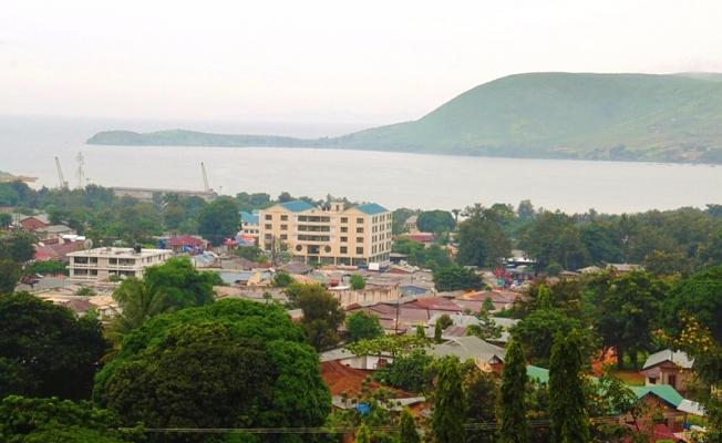
-Tourism Circuit Kigoma Ujiji Municipality is endowed with white sand beaches along the Lake Tanganyika; the detailed design of Lay out for development of Hotel Sites totaling 145 Hectares of land is at an advanced stage.
LAND AND AREA USE.
The entire region has ana area of 45066 square kilometres which is equivalent to 4.8% of the total area of Tanzania of which 8029 sq.km is water and 37,037 is land area.
AGRO-ECONOMIC ZONES
The region can be divided into four (4) agro economic zones on the basis of altitude and corresponding annual rainfall which is
described as follows.
THE LAKE- SHORE ZONE
This zone lies within altitude of 800-1000 metres with annual rainfall of 600-1000 mm. The Lake-shore Zone forms an arrow strip of land between Lake Tanganyika and the mountains dissected by numerous streams flowing into the lake creating in the process valleys in a few locations which support paddy farming. Cassava, maize, beans and oil palm are also grown. The main
economic activity is fishing. Population is sparsely distributed with more concentration on the shores of the lake.
THE MIOMBO ZONE
.The Miombo zone lies within altitude 1000 and 1200 metres with rainfall of 600-1000mm. The areas is generally covered with miombo woodland and is sparsely populated due to tsetsefly infestation. Economic activities include cattle rearing, hunting and
honey/bees wax gathering with agriculture.
INTERMEDIATE ZONE
this zone lies between 12001500 metres above sea level with an annual rainfall of 850 mm to 1100 mm. The zone is characterized by swampy area which provide great potential for irringation. Population in this zone developed from both organised and spontaneous resettlement mainly from the Highland. Common food crops include cassava, maize, beans and sorghum/millet while oilpalm, cotton and tobacco constitute the cash crop package.
THE HIGHLAND ZONE
This zone lies within the altitude of 1500 metres to 1750 metres with annual rainfall of 1000-1600 mm. The zone is divided into
two main parts. In the north the zone is located above the intermediate zone and has a high population. In the south there is a
separate highland area and the Mahale mountains reaching a maximum altitude of 2373 metres. This area is uninhabited and
most of it has been designated a National Park. Another National Park is the Gombe stream situated North of Kigoma town,
for tourist attraction due to the existence of thechimpazees.Common food crops include maize, beans and bananas with
coffee in the higher wetter areas
ADMINISTRATIVE UNITS
Kigoma region was formed with Kigoma/ Ujiji town as headquarters when the former eight colonial provinces were finally
split into 17 regions in 1963. Previously the region was part of the former Western Province with its headquartes at Tabora.The region is divided into six administrative districts of Kigoma,Kasulu,Kibondo,Buhigwe,Kankonko and uvinza.The district
s are further divided into smaller administrative units known as divisions, wards and finally villages. In the case of Kigoma, it is divided into 18 divisions, 81 wards and 220 villages